Written by: Andrew Forrest
Updated: July 2025
The hiking community has its own unique lingo. Here are some terms (including local ones) that you might come across on this website or from other walkers, along with their explanations:
 |
 |
'A Pennine Journey' is a 247-mile circular walking route that begins and concludes in Settle, covering sections of Hadrian's Wall, the Yorkshire Dales, the Eden Valley, and County Durham. This route draws inspiration from Alfred Wainwright's walk in 1938. The Yorkshire Three Peaks walk and 'A Pennine Journey' share the same path along parts of Ingleborough and Whernside.
Wet, marshy ground characterises the Dales, which feature peat bogs in flatter areas. The term 'Boggy section' indicates that you may encounter muddy or wet feet. The sections between peaks, particularly between Pen-y-ghent and Ribblehead, were especially boggy after rainfall, prompting a change in the route and the construction of new paths to avoid these areas.
A route available for walkers, horse riders, and cyclists, although cyclists must yield to both walkers and horse riders. Motorised vehicles are not permitted on this route.
A man-made pile of stones designating a summit or route. The summits on the Three Peaks each feature trig pillars, but you may occasionally encounter cairns along paths or at secondary tops.
The lowest point on a ridge between two peaks (also called a saddle or pass).
A compass, essential for every walker, is a device with a magnetic needle that indicates direction by pointing north, making it invaluable for map reading!
A line on a map that joins points of equal height. These are the thin brown lines found on Ordnance Survey maps, and if you look closely, you will notice that occasionally along the brown line, it indicates the height of that contour.
If in an organised event, a time by which you must reach a certain point to be allowed to continue. Independently, you might set your own to ensure you are not left in the dark.
A valley, particularly in Northern England. There are many dales in the Yorkshire Dales, which include: Arkengarthdale, Barbondale, Coverdale, Dentdale, Kingsdale, Littondale, Malhamdale, Ravenstonedale, Ribblesdale, Swaledale, Wensleydale, Widdale, and Wharfedale. Most of the Yorkshire Three Peaks walk is situated in Ribblesdale.
|
|
The Dales High Way is a 90-mile walk from Saltaire to Appleby-in-Westmorland that traverses the Yorkshire Dales. The Yorkshire Three Peaks route follows the same path as the Dales High Way for part of the Ingleborough and Whernside sections of the walk.
Borrowed from running, if you don't complete the challenge. No shame in a DNF - the mountains will be there for another try, and it's better than risking injury or getting lost in the dark.
If you plan but don't start. Hopefully not relevant, but if the weather is awful, a DNS might be the bravest choice.
The total of all individual height gains during your walk is the overall climbing that you will undertake. On the Yorkshire Three Peaks walk, this equates to 1,610 metres of climbing.
A term used in Northern England for a hill or mountain (of Norse origin from the word fjall). All Three Peaks are often called 'fells'.
These are posts, often constructed from wood, that function as directional signposts in the shape of a finger, usually indicating the distance to a particular location. They typically feature between one and four fingers.
A gaiter is a protective fabric that is secured to your boot and lower leg. Its main function is to shield your feet and lower leg from mud, water, debris, and shrubs.
The Global Positioning System (GPS) is a network of satellites that provide locational information. When you use mapping applications on your mobile or GPS device, and your device displays your location, that information is transmitted to your device via GPS. Many hikers utilise GPS tracks for the Three Peaks challenge. This is useful, but always carry a map as a backup, as batteries can deplete or you may not get a signal.
A map-based coordinate (typically an OS grid in the UK). When calling for rescue, a six-figure grid reference (e.g., SD 838 734) is very useful for pinpointing the location on an OS map.
A hard, coarse sandstone rock found on summits. It often forms crags and rocky outcrops. You see this on Pen-y-ghent's cap - those gritstone ledges you scramble up. It was also known as Quernstones, hence Whernside's name meaning.
A head torch (or headlamp as they are known in certain regions around the world) is a light that provides hands-free illumination worn on the head. They are invaluable for hiking in the dark.
Landscape underlain by limestone that has been eroded to form tunnels, caves, sinkholes, and pavements. The Three Peaks area is classic karst terrain.
A gate, usually wooden, is hung to create a U or V shaped enclosure that permits only one person to pass through at a time.
A flat expanse of exposed limestone rock, consisting of blocks (clints) of limestone and divided by fissures (grikes). It is highly prominent around Ingleborough. The surface tends to be slippery when wet and provides a habitat for rare ferns and flowers in the grikes. Walking on limestone can be very slippery when wet.
In the UK, a mountain, as opposed to a hill, is typically defined as an area of land that rises to more than 2,000 feet (610 m). Therefore, all the Yorkshire Three Peaks - Pen-y-ghent, Whernside, and Ingleborough - are classified as mountains.
Partially decayed plant matter forms soil in bogs, feeling spongy underfoot and often appearing black and muddy. Peat bogs cover parts of the slopes of the peaks. Stick to paths and boards through the peat sections to avoid erosion and to keep your boots from sinking.
|
|
The 268-mile national trail that goes over Pen-y-ghent. The Yorkshire Three Peaks path shares a short section with it up Pen-y-ghent and down toward Ribblehead.
|
|
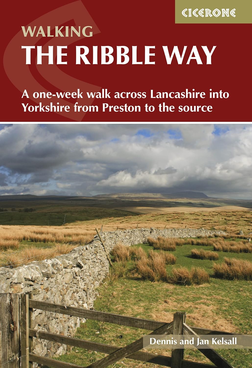
The Ribble Way is a 72-mile walk from the Ribble's estuary mouth near Preston to its source on Cam Fell in the Yorkshire Dales.
In England, a legal path across land. The Three Peaks route follows public footpaths and bridleways. Footpaths are for walkers only, whereas Bridleways are for walkers, cyclists, and horse riders.
Using hands as well as feet to climb up a steep section of rock. Pen-y-ghent has a short scramble near the top - nothing technical, just a bit of easy rock clambering. Not the same as rock climbing (no ropes needed), but beyond simple walking, where you may have to use your hands for a very short section.
Local term for a sinkhole - a depression formed by collapse of soil into a cavity below or by dissolving limestone. Usually grassy and rounded. Keep an eye open, don't wander into one while admiring the view!
A step or ladder contraption to cross over a wall or fence. You used to cross several stiles along the route, but all have now been replaced with gates and in some cases double gates.
The top of a hill or mountain. Each of the Three Peaks has a summit marked by a trig point.
Don't confuse the Yorkshire Three Peaks with the National Three Peaks, which involve the highest peaks in Scotland, England, and Wales (Ben Nevis, Scafell Pike, Snowdon). The Yorkshire Three Peaks challenge requires completing the Yorkshire Three Peaks walk in under 12 hours, whereas the National Three Peaks challenge entails completing the National Three Peaks and all the driving in between in under 24 hours.
A concrete pillar used historically for map-making triangulation. There's one on each of the Three Peaks. Many walkers touch the trig as the official 'summit reached' ritual... they are also good places for photo stops!
A low-lying area of land, typically 'U' or 'V' shaped, situated between hills or mountains, often with a stream flowing through it.
Signs or painted marks indicating the route. The Three Peaks route has some waymarking (signposts at certain junctions) all the way around it.
This glossary could go on (outdoor folks have many terms!), but the above covers those most likely to arise. If you wish to read a more extensive list of hiking terms, take a look at our glossary of walking, hiking, and rambling terms. Familiarising yourself with these terms helps you communicate with fellow walkers and understand advice. Now, equipped with vocabulary and knowledge, you're even better prepared to converse like a seasoned hiker during the walk!