
Written by: Andrew Forrest
Updated: July 2025
While Whernside, standing at 736 m (2,415 ft), is the tallest of the Yorkshire Dales' renowned Three Peaks, it is also the highest mountain in Yorkshire. It rises with a long whaleback profile between the valleys of Ribblesdale (to the east) and Dentdale/Kingsdale (to the north and west) and looms over the Ribblehead Viaduct below.

Whernside from the Ribblehead Viaduct
In contrast to the steeper peaks of nearby Ingleborough and Pen-y-ghent, Whernside features a broad, gentle slope that offers a rewarding ascent and some of the most breathtaking views in the area. Hikers travel from far and wide to conquer Whernside, whether as part of the Yorkshire Three Peaks Challenge or on a leisurely day walk, to savour its natural beauty and expansive vistas.
This page contains affiliate links. If you buy products or services via these links, we may earn a small commission at no cost to you. If you are thinking of buying, please use our links, as it helps support our website and YouTube channel.
Like its neighbours, Ingleborough and Pen-y-ghent, Whernside is formed of classic Yoredale series geology, a layered cake of sedimentary rock from the Carboniferous period. This geology gives Whernside its distinctive shape and features:
Limestone Base: The lower slopes, particularly on the south (Twisleton) and west sides, consist of Great Scar Limestone. Over time, the erosion of this limestone has formed cliffs and scars (such as Twisleton Scar), as well as limestone pavements and caves. Outcrops of pale grey rock and shakeholes, where water has dissolved the stone, can be seen. The limestone also enriches the soil, allowing lush green pastures and unique wildflowers to thrive at lower elevations.

Looking across over limestone outcrops on Whernside towards Ingleborough

One of the strange shaped limestone potholes on Whernside
Sandstones, shales, and grit: Above the limestone, there are alternating bands of sandstone, mudstone, and shale (the Yoredale beds). These layers are less permeable, causing water to run off, which leads to the formation of springs and becks, such as Force Gill.

Looking towards Force Gill waterfall after a period of dry weather from the Yorkshire 3 Peaks path heading towards Whernside
Gritstone Cap: The summit of Whernside is capped with a hard, coarse sandstone (known as gritstone). This cap rock is particularly resistant to erosion and weathers into plateaus. That is why Whernside's summit ridge is relatively flat and broad. The gritstone also imparts a reddish hue to the soil and broken rock at the top. Its surface is rough underfoot yet durable - the path runs over flagstones made from local gritstone on its way to the summit wall.

Kingsdale in the Yorkshire Dales on the north side of Whernside
During the last Ice Age, glaciers shaped Whernside's sides, giving it its gentle profile. They also carved the U-shaped valleys, such as Kingsdale and Dentdale, on either side. As the ice melted, streams and waterfalls further sculpted the landscape, which is why there are many dramatic waterfalls to the south-west (Ingleton waterfalls walk).
Whernside's diverse habitats, including wet summit bogs, dry limestone grasslands, heather moors, and sheltered valleys, support a wide range of wildlife. Although much of the mountain consists of open fell tops and sheep-grazed slopes, there remain plenty of natural sights for observant walkers.
The uplands are home to classic moorland birds. Listen for the bubbling call of the Curlew in spring and the distinctive 'go-back' cry of the Red Grouse hiding among the heather. Skylarks are common on summer days, hovering and singing high above the slopes.
You might spot Meadow Pipits flitting among the grasses, and in rocky areas, a Wheatear or two perching on walls. In the valleys, you'll hear the bleating of upland farm animals, and you should also look for lapwings displaying over the pastures and grey wagtails bobbing along becks.
On the high plateau, hardy vegetation such as heather, bilberry, and cotton grass prevails, giving the hill a purple-white blush in late summer. The boggy flats near the tarns host sphagnum moss and other bog-loving plants.

The tarn on Greensett Moss just below Whernside's summit, with Ingleborough in the background
As you descend to the limestone ground, the flora becomes increasingly diverse. In spring, the limestone meadows on Whernside's lower slopes (especially on the southern Twisleton side and in Chapel-le-Dale) bloom with wildflowers such as primrose, wild thyme, and the purple orchid. In rocky grikes (crevices), you might find ferns and species like bird's-eye primrose.

One of the strange shaped limestone pots on Whernside with Ingleborough in the distance
Whernside's habitats are largely shaped by farming (sheep grazing - mainly Swaledales) and moorland management. Visitors can help protect wildlife by sticking to established paths (to avoid disturbing ground nests or trampling rare plants). Dogs should be kept on leads during lambing season and ground-nesting bird season. When walking, please carry out any litter (even organic scraps) to keep the mountain safe for animals.
On a clear day, the summit of Whernside rewards walkers with a 360° panorama of peaks, valleys, and even distant seas. To the south, the flat-topped silhouette of Ingleborough is unmistakable, and beyond it to the southeast lies Pen-y-ghent.

Looking towards Ingleborough from the summit of Whernside
Looking westward, you can see the silver gleam of Morecambe Bay on the Irish Sea coast, and above it on the far horizon rise the mountains of the Lake District. The western foreground is dominated by the rolling green hills of Lancashire, notably Gragareth and Green Hill, the highest points in Lancashire.

Looking towards Morecambe Bay and the Lakeland Fells from Whernside's summit
Turning north, you gaze over the tranquil valley of Dentdale. Widdale Fell rises to the north-east, with Great Shunner Fell beyond. To the north and north-west are the gently rounded Howgill Fells, often seen in silhouette. Each direction offers something special - from mountains and moors to sea and sky - making the panorama from Whernside's summit one of the finest in Yorkshire.

Looking towards the Howgills from the summit on Whernside
There are two named trails that either pass over or are on the flanks of Whernside.
 |
 |
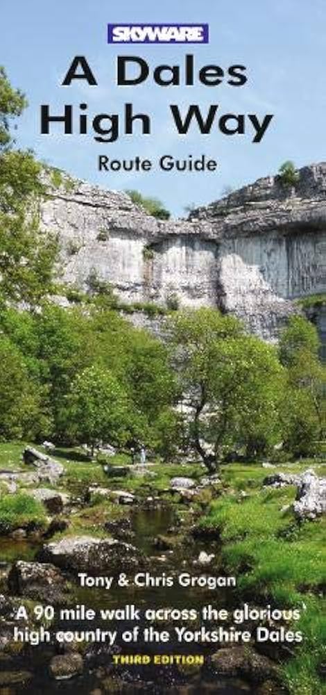
The Dales High Way is a long-distance trail that traverses the flanks of Whernside. It is a 90-mile (140 km) walking route from Saltaire in West Yorkshire to Appleby-in-Westmorland in Cumbria. The route showcases the stunning upland scenery of the Yorkshire Dales. Notably, the Dales High Way passes through the Yorkshire Three Peaks area. After climbing Ingleborough (at 724 m, the highest point of the High Way), it descends into Chapel-le-Dale and skirts around Whernside.

Looking back down the Dales High Way as it passes around Whernside towards Pen-y-ghent and Ingleborough
Whilst the Dales High Way does not go over Whernside's summit, it runs along Whernside's northern flank. From the Ribblehead Viaduct, the path follows the railway for a short distance before crossing Whernside's upper slopes to the north of the summit and descending into Dentdale. Walkers on the Dales High Way are treated to magnificent views of Whernside's sweeping sides and the valley below, without the need for an additional climb to the top. For those who do want to 'bag' the summit, a short detour upwards can be made.

The Dales High Way path as it passes through fields on the lower slopes of Whernside, with the Ribblehead Viaduct visible in the distance
Although the Dales High Way was established in 2007, the waymarking was finalised in 2013, and it was included in OS maps in 2014.
|
|
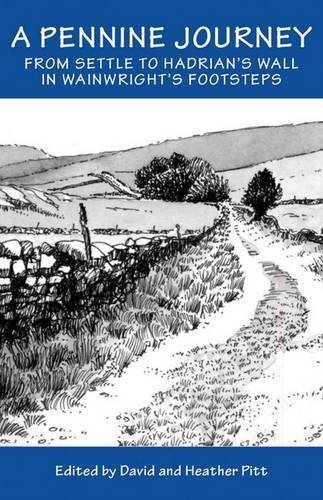
Another notable trail crossing the area is 'A Pennine Journey', a circular long-distance footpath inspired by a historic walk that passes over the summit of Whernside. 'A Pennine Journey' was devised using existing roads and rights of way to closely follow Alfred Wainwright's original 1938 walk, which he documented. His 'A Pennine Journey' walk was published in 1986.
This circular walk is 247 miles long, starting and finishing in Settle, situated in the Yorkshire Dales National Park. The route primarily ascends the eastern side of the Pennines to Hadrian's Wall, which it follows for 21 miles before returning south along the western side of the Pennines, over Cross Fell and down the Eden Valley, passing through Sedbergh and Kirkby Lonsdale on its way back to Settle.

Following the 'A Pennine Journey' path on the lower flanks of Whernside
Whernside features on the return leg of 'A Pennine Journey'. As previously mentioned, after reaching Hadrian's Wall, the route loops back south through the Eden Valley and Howgill Fells, re-entering the Yorkshire Dales near Garsdale. It then passes through Dentdale and ascends Whernside before dropping into Ingleton. In fact, Whernside is one of the two Three Peaks summited on this trail, the other being Ingleborough.
Whernside doesn't stand in isolation; it is surrounded by distinctive dales, ridges, and trails that enhance any visit. Below are some adjoining features and reasons they're worth exploring:
Whernside's secluded Kingsdale Valley is a hidden gem for tranquillity and limestone scenery. This high, 'U-shaped' glacial valley separates Whernside's eastern slopes from the Gragareth/Great Coum range to the west. A narrow road from Ingleton leads to Dentdale, offering a scenic drive and walking area. Kingsdale Beck drains the valley, flowing south to become the River Twiss, one of the two rivers that form the famous Ingleton Waterfalls.

Looking down into the Kingsdale Valley from Whernside
Kingsdale offers tranquillity and geological wonders. This valley is serene and untouched compared to the bustling Ribblesdale, where one might encounter only grazing sheep or a cyclist. Beneath its pastures, Kingsdale conceals a labyrinth of caves and potholes, including systems of national significance shaped by water over millennia.
Yordas Cave, a former Victorian show cave, is a notable example, accessible via a brief detour from the road. Adventurous visitors can explore its spacious chamber with a torch, where a subterranean waterfall awaits. Above ground, enjoy splendid views of Whernside's western face, with steep, less frequented paths leading up its flanks. In short, Kingsdale is a peaceful haven next to Whernside - ideal for a quiet picnic, caving, or an 'off-the-beaten-path' walk in the Dales. Please be aware that Yordas Cave is on private land.
On Whernside's southern side, a long spur known as Twisleton (often spelt Twistleton on older maps) extends westward towards Ingleton. The ridge features Twisleton Scars, impressive limestone cliffs forming tiered 'scars' on the hillside. These outcrops are part of the classic Dales geology (the same Great Scar Limestone at Malham Cove and Ingleborough's cliffs) and create a dramatic landscape of terraces, clints, and grikes, offering superb viewpoints.
From Twisleton Scar End, you can see Ingleborough to the south, Ingleton village to the west, and Kingsdale to the north - a fantastic view. It is a favourite spot for photographers and is usually quieter than the Three Peaks summits. Twisleton was crossed by the old Roman road (the Craven Way) linking Ingleton to Chapel-le-Dale, and today Twisleton Lane follows part of that route.
Walkers on the Ingleton Waterfalls Trail go along Twisleton Lane near Scar End, unknowingly traversing the lower flank of Whernside. This is at the northern end of the waterfall walk - a must-do if you've never experienced it. Twisleton offers insights into Whernside's geology and stunning views without requiring the full ascent. A short hike from Ingleton to Twisleton Scar unveils magnificent valley vistas and rare limestone-loving wildflowers in the summer. If time permits, be sure to visit Twisleton Scar - it provides a striking foreground for Whernside and is excellent for landscape photography.
Whernside can be climbed via several routes, each offering its unique character. The three most popular approaches are from Ribblehead, Bruntscar/Chapel-le-Dale, and Dentdale. Although all lead to the same long summit ridge, they differ in difficulty, scenery, and popularity. Below is a brief overview to assist you in planning your walk:

Whernside and the Ribblehead Viaduct

Looking back up towards Whernside's summit from near Bruntscar up the footpath that is the Yorkshire Three Peaks path and part of the 'A Pennine Journey' path
There is also a longer route up from Twisleton, which follows the wall for almost its entire 6-mile route to the top. Whatever route you
choose, be sure to carry a map. In poor visibility, note that Whernside's top is a broad ridge; the path follows a wall, which helps with
navigation.
The summit itself is marked by a cairn and trig point on the west side of the wall. In winter, snow and wind can make the ascent challenging, so check conditions. Conversely, in summer, bring sun protection and water, as the open ridge offers little shade.
The name 'Whernside' was first recorded in 1202 as Querneside, meaning 'hillside of the querns (millstones)'. It derives from the Old English cweorn, which means a quern or hand-millstone, and the Old English sīde, meaning hillside.

Yorkshire Three Peaks Public Footpath sign pointing towards Whernside
This indicates that millstone grit from the flanks of Whernside was prized for producing grinding stones during medieval times. In fact, the upper gritstone layers could provide durable stone for mills.
During the 12th century, much of this area was monastic land. Historical records indicate that Furness Abbey owned grazing land (vaccaries) around Whernside (referred to as 'Querneside') and in the nearby valleys. Monks and lay workers would have managed sheep and cattle on these hills.
The old walls and ruins of barns that you occasionally see may date back to those times or later, as farming has taken place here for hundreds of years. Chapel-le-Dale, located on Whernside's southern flank, features a 17th-century chapel that served scattered farming families and later railway navvies.
An interesting fact emerged from the county boundary changes in 1974 when Whernside's summit marker was moved into a different county. With the traditional West Riding of Yorkshire being redrawn, the county line between Cumbria and North Yorkshire was established to run across Whernside's summit. Consequently, the stone trig pillar that marks the peak ended up just through the gap in the wall on the Cumbria side of that line. So, when you touch the trig point, you're technically stepping into Cumbria, even though you've climbed Yorkshire's highest peak.

The hole in the wall, through which is the trig point on Whernside's summit
One of the most dramatic and visually striking historical events in Whernside's vicinity was the construction of the Settle to Carlisle Railway from 1869 to 1875. The Ribblehead Viaduct, located at Whernside's south-eastern base, is an iconic 24-arch stone viaduct that carries the railway across Batty Moss.

Looking up at two of the arches in the Ribblead Viaduct
Its construction brought a temporary town of workers to this remote area. Over 2,000 navvies and their families lived in shanty camps at Ribblehead (with names like Sebastopol and Batty Wife Hole) while they laboured to complete the line. Many perished due to harsh winters and dangerous work; they are commemorated at the church in Chapel-le-Dale. The railway also passes through Whernside itself via the Blea Moor Tunnel - 2.4 km long - just north of the viaduct, making it the longest tunnel on the line.

A memorial by the Settle to Carlisle railway to those who originally built it and to those who repaired it
Today, the viaduct stands as a testament to the might of Victorian engineering, beautifully framing Whernside's profile. In summer, steam trains sometimes travel along the line, where many photographers can be seen waiting to capture images of them passing over the viaduct, with Ingleborough or Whernside in the background.

Looking towards Ingleborough through the Ribblehead Viaduct
Yorkshire Dales National Park Authority
Grough online
Yorkshire Dales Place Names - Robert Gambles
The Three Peaks of Yorkshire - Harry Ree and Caroline Forbes